Introduction
When embarking on a complex civil engineering, environmental, or landscape project, the tools you choose can dramatically impact every stage of the process. Whether you’re planning site developments, assessing landscape impacts, managing tree retention, or designing aesthetically appealing outdoor spaces, the right software solutions can help streamline your workflow and improve project outcomes.
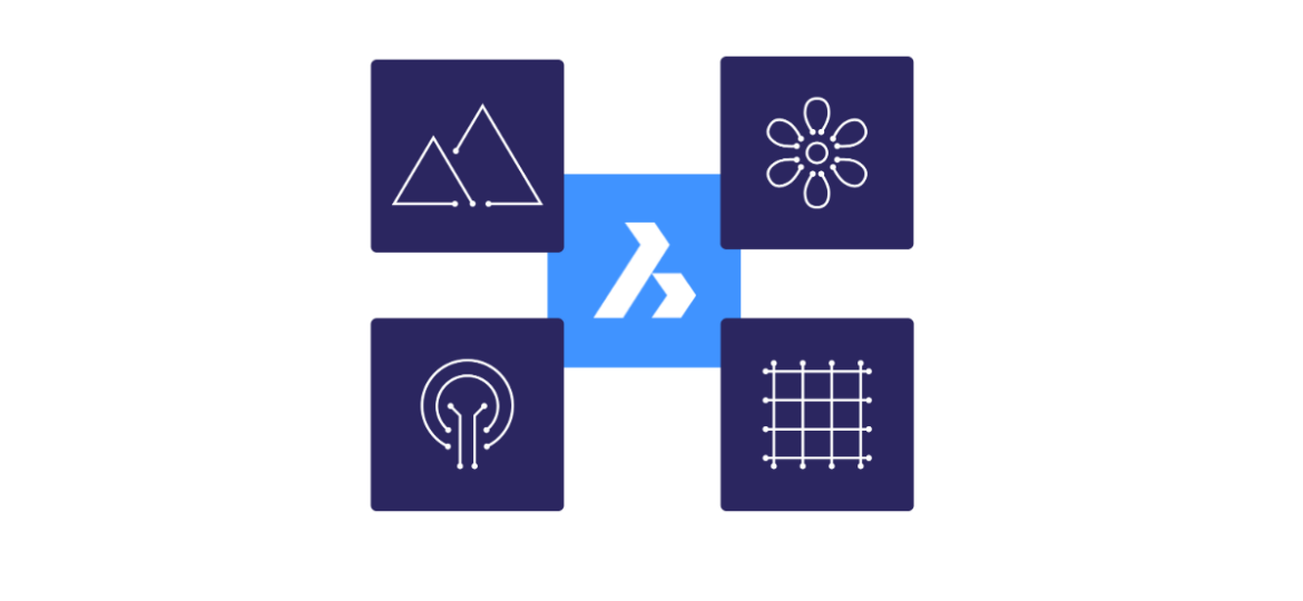
KTF Software offers a comprehensive suite of tools, including BricsCAD, KeyTERRA-FIRMA, Qarb, ZTV, and Qscape, that takes your project through each essential phase — from initial site analysis to final landscape design. Let’s take a look at how this software ecosystem supports and enhances every step of the journey.
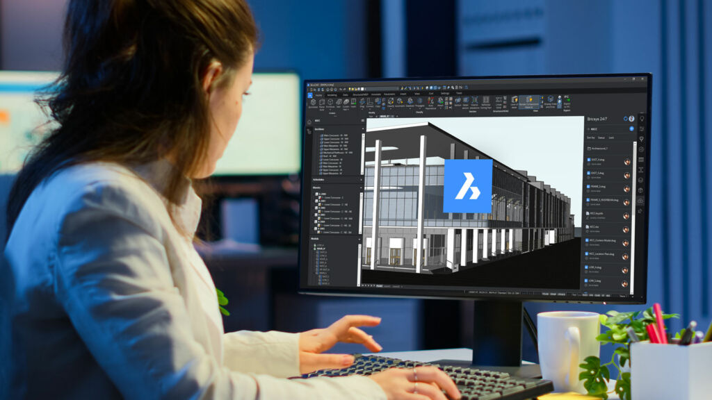


1. The Foundation: BricsCAD – The CAD Engine You Can Rely On
Every successful project begins with a strong foundation, and that’s where BricsCAD comes in. Known for its compatibility, power, and affordability, BricsCAD is the essential CAD engine at the heart of the KTF suite. It offers advanced 2D and 3D design capabilities while being fully compatible with other industry-standard formats, ensuring that your work integrates seamlessly with any other tools in your workflow.
BricsCAD’s strength lies in its ability to handle complex models and designs efficiently, without the high costs associated with other CAD platforms. It’s the backbone upon which the rest of your project journey is built, whether you’re analyzing sites or designing infrastructure.
2. Early Stages: KeyTERRA-FIRMA – Informing Early Decisions
The first critical phase of any civil engineering or environmental project involves site analysis and ground modeling. Enter KeyTERRA-FIRMA, the tool designed to provide accurate ground data that informs your decisions from the earliest stages.
With KeyTERRA-FIRMA, civil engineers can model terrain, analyze topographical data, and quickly assess the suitability of a site for development. This eliminates the need for costly on-site surveys in many cases and ensures you have a detailed understanding of the landscape before breaking ground.
The software’s powerful cut-and-fill analysis tools, combined with its ability to integrate Lidar and other geospatial data, make it an indispensable part of any site planning process. By using KeyTERRA-FIRMA, you gain the confidence to make informed decisions about site layout, infrastructure, and environmental impact early on, saving time and reducing risks later in the project.
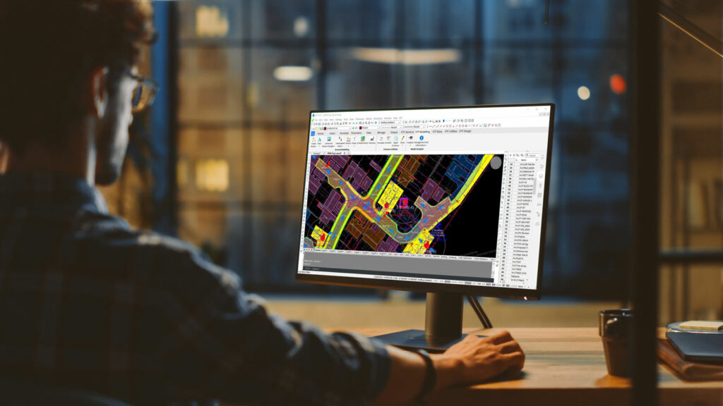
3. Assessing Visual Impact: ZTV – The Landscape Planner’s Best Friend
Once the site has been analyzed and early decisions made, the next step is often assessing the visual impact of the development. ZTV (Zone of Theoretical Visibility) is the ideal tool for landscape planners and architects looking to understand how their project will interact with its surroundings.
ZTV enables you to analyze the visibility of your development from key vantage points, ensuring that your design respects the natural landscape and complies with local planning regulations. For projects in sensitive environments — like those near residential areas or protected landscapes — this kind of analysis is essential. ZTV helps you visualize how your project will be perceived by the public, helping to mitigate any potential concerns about its visual footprint.
By modeling the landscape and analyzing zones of visibility, ZTV allows planners to make data-driven decisions that protect scenic views while integrating the project harmoniously with the environment.
4. Tree Assessment and Protection: Qarb – Making Informed Choices
A key concern in many projects is how to manage trees on the site, particularly when dealing with ecologically sensitive areas or existing woodland. This is where Qarb shines.
Qarb allows environmental consultants and landscape planners to make informed decisions about which trees to retain, remove, or protect during development. It integrates seamlessly with the rest of the KTF suite to provide a clear picture of how the site’s vegetation interacts with the planned infrastructure.
By evaluating tree placement and health, Qarb ensures that your project adheres to environmental standards, while balancing the need for development with ecological preservation. This is particularly useful in urban planning, where trees play a vital role in maintaining biodiversity and contributing to the aesthetic and environmental quality of the area.
5. Final Aesthetic Touches: Qscape – Designing for the Future
With the site analyzed, trees assessed, and the visual impact evaluated, the last phase of the project journey is landscape design. Qscape helps landscape architects create visually appealing, functional designs that add the finishing touches to any project.
Qscape makes it easy to design green spaces, planting schemes, and other landscape features that will not only enhance the project once built but also improve its usability for future stakeholders. Whether you’re designing public parks, corporate campuses, or residential developments, Qscape allows you to create beautiful, sustainable outdoor environments that fit the needs of the people using them.
From specifiying plant arrangements to planning long-term landscape management, Qscape helps ensure that the end result is as practical as it is attractive.
6. The Complete Journey: Seamless Integration for Maximum Efficiency
One of the greatest advantages of using the KTF suite is the seamless integration between tools. BricsCAD acts as the core platform, with each additional tool providing specialized capabilities that build upon the groundwork established in earlier stages. This means you can move from site analysis (KeyTERRA-FIRMA), to tree assessment (Qarb), to landscape impact evaluation (ZTV), and finally to landscape design (Qscape), all within a cohesive workflow.
The result is a streamlined, efficient project journey that minimizes the time and cost of design, while maximizing accuracy and environmental compliance.
Conclusion: The Project Journey with KTF Software
The KTF Software suite offers a holistic solution for civil engineers, landscape planners, and environmental consultants who need reliable, cost-effective tools to take a project from concept to completion. With BricsCAD at the core and specialized tools like KeyTERRA-FIRMA, Qarb, ZTV, and Qscape to enhance each stage of the journey, you can be confident that your project will be delivered on time, on budget, and with the highest quality of results.
Whether you’re managing site analysis, assessing environmental impact, or designing a future-proof landscape, KTF’s solutions will help you succeed at every turn. Ready to take your project on a journey? Start with KTF Software and see the difference.
Don’t just take our word for it. See how multidisciplinary environmental consultants Enzygo utilize KTF Software products at every step of the project journey in this Case Study.