
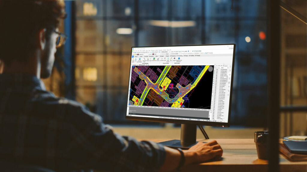
KeyTERRA-FIRMA is a specialist CAD plug-in for BricsCAD® and AutoCAD® designed to make terrain modeling, road and site design, and survey data processing faster, more accurate, and easier to manage. It delivers powerful, intuitive tools to create surfaces, sections, and 3D models directly within your DWG environment, without leaving your CAD workflow.
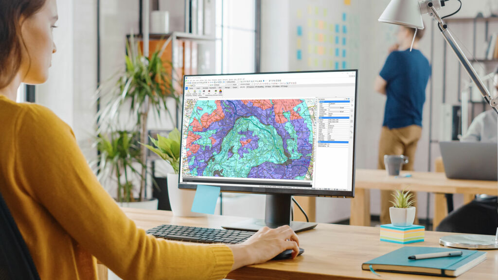
Work with survey data, generate terrain surfaces, and create sections and profiles. All within your CAD workflow.
Design roads, set out levels, and develop site layouts with tools built for real-world civil engineering projects.
Create sections and profiles directly from your survey data, with clear, accurate CAD outputs and minimal manual work.
Designed for engineers who need accurate results without unnecessary complexity, KeyTERRA-FIRMA fits directly into your existing CAD workflow. It simplifies complex surveying, terrain modeling, and design tasks, helping you work faster, reduce manual effort, and produce reliable outputs without switching platforms.
The system is simple to use, extremely flexible and suitable for a wide range of objectives. In addition to typical development and road design projects, KeyTERRA-FIRMA has been used in Coastal Erosion studies, Hydrographic Surveys, Landfill Projects, Quarries and Airfield approach studies.

Process survey data, model terrain, and deliver accurate designs faster, directly inside your CAD environment.
KeyTERRA-FIRMA works seamlessly with both BricsCAD Pro and AutoCAD, running directly inside your familiar DWG environment.
Whether you’re working in AutoCAD or exploring alternatives, you can work with the same drawings, tools, and workflows without disruption.
This gives you the flexibility to stay where you are or move to a more cost-effective CAD platform when you’re ready.
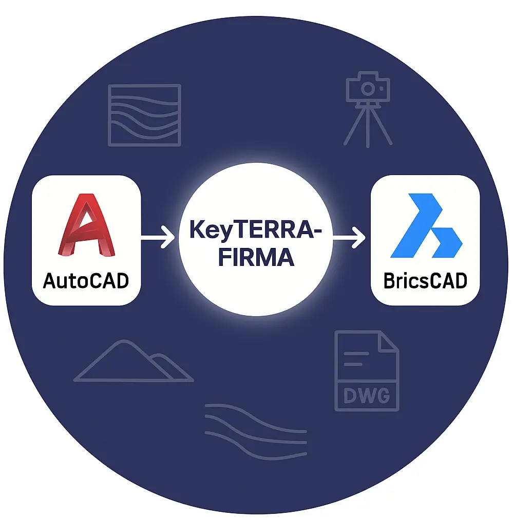
KeyTERRA-FIRMA runs natively inside BricsCAD, using real DWG files and standard CAD commands. There are no workarounds. Just a fast, modern CAD platform built for performance and efficiency.
It’s a natural choice for teams looking to reduce software costs without changing how they work.
KeyTERRA-FIRMA works seamlessly within full versions of AutoCAD, integrating directly into your existing CAD environment.
You can continue using your current setup, workflows, and standards, simply extending AutoCAD with powerful civil engineering tools.
We don’t just sell KeyTERRA-FIRMA; we fully support it.
You get direct access to real people who use the software every day and know it inside out. No ticket systems, no generic replies, just clear, practical help when you need it.
Whether it’s setup, licensing, or a technical issue, we focus on one thing: getting you moving quickly.
Support includes phone assistance with UK-based experts, live problem-solving via TeamViewer, and tailored video guidance.
But we go further than most. As developers, we can adapt the software to your workflow, whether that’s custom routines, automation, or entirely new features.
The result? Less clicking, fewer workarounds, and software that fits how you actually work.

We’ll review your requirements and confirm if a Proof of Concept is the right approach before getting started.
We’ll help you understand what’s active, where, and what to do next.